


Home \ International \ Digitalization on the site!
Digitalization on the site!
31/03/2021
Pubblicato da Redazione Redazione
Drone and GPS for more efficiency in excavation pit construction
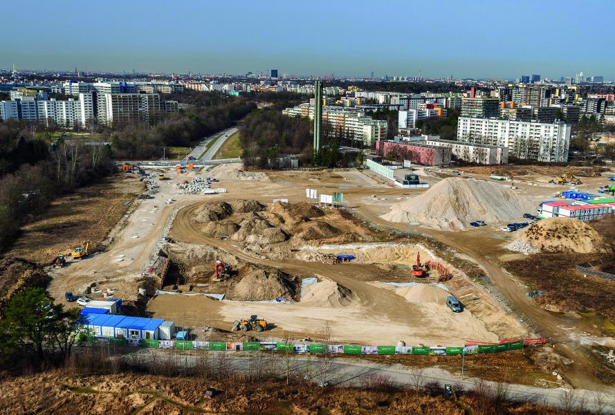
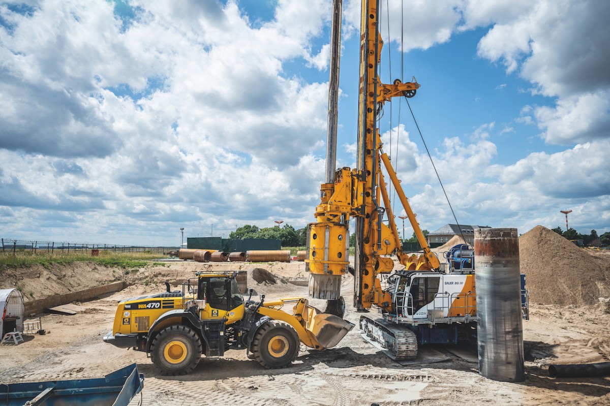
On an area where gravel was formerly excavated the construction project Pandion Verde is currently being is realized: At the former “Piederstorf” site in Munich’s Neuperlach District, three building complexes comprising a total of six houses and 256 apartments are being built on an area of around 20,000 m2 to harmoniously integrate into the 12.8 ha Alexis Quartier.
Ideally located in the southeast of Munich, right beside the Trudering Forest and close to the city of Munich and the major employers in the north and east of the state capital, the future urban district will create the perfect connection between home, work and lifestyle. To make all of this possible, Bauer Umwelt, the environmental division of Bauer Resources GmbH, was tasked with the construction of an excavation pit. A total of 25,000 m3 of material – of which around 5,000 m3 consisted of concrete demolition – was excavated to a depth of 4 m and disposed of. In addition, a 60 cm thick filter layer was installed to allow rain water to be discharged into the construction soil and the natural aquifer.
“A comparatively simple pit construction,” says Jan Uhlig, Operations Manager at the Bauer Umwelt Division. “But still a true highlight in terms of digitalization”. The secret “star” was a drone – or rather the footage material and data generated by it. This drone was used for surveying the excavation pit and the masses that needed to be moved. “It had a real advantage in terms of speed. Manual surveying methods often take up several days while a drone flight takes just a few minutes and the processing of the data just a few hours,” explains Jan Uhlig. And that’s not all: The amount of detail in the images revealed a discrepancy of a few centimeters between the excavation pit and the design – an immensely valuable information for the execution of the work itself.
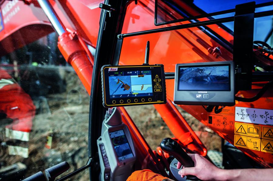
But the drone was not the only “star” on the site – it was aided by a GPS-controlled excavator to create the shaping of the excavation base by means of a generated 3D model. “Using the base grade as the foundation level for the actual foundation of a building requires precision,” stresses Erwin Resch, Senior Foreman at the Bauer Umwelt Division. “Every centimeter is precision work to keep tolerances as low as possible.” Once the rough work had been completed with a 35 t excavator, the GPS-controlled excavator was used to work on the finishing touches.
Thomas Erwert had to adhere to a positional accuracy of +/- 2 cm in accordance with the terrain model – no problem for the experienced excavator driver from the Bauer Umwelt Division. Moreover, the GPS control also had a decisive edge in terms of time and cost savings: The excavator driver was able to work selfsufficiently without needing to rely on additional support staff at the site, such as a surveyor for allocating the stake-offs at specified heights of the excavation pit. Disruptions were also avoided as the excavator driver could continually monitor the work progress on the integrated display in real time. The work was mostly completed on schedule in March. Once the shell for the basement is finished, Bauer will install an infiltration chamber over the course of the year.
Ultime notizie di Bauer Macchine Italia
Perforation
05/12/2023
Bauer relies on full e-power during Dutch infrastructure project
Innovative electric drill rig from Klemm in operation for th...
Perforation
04/11/2023
Bauer India constructs the deepest diaphragm wall element
Bauer India constructs the deepest diaphragm wall element du...
Perforation
27/10/2023
Klemm Bohrtechnik GmbH celebrates double anniversary
This year, Klemm Bohrtechnik GmbH is celebrating two anniver...
Perforation
26/09/2023
Brownfield Remediation from A to Z on Berlin Airport Grounds
Alongside the operations building, they also needed to disma...
Perforation
30/08/2023
Bauer Spezialtiefbau executes foundation works for the world’s largest monopile manufacturing facility for offshore wind
SeAH Wind Ltd. commissioned the Joint Venture between Bauer...
Perforation
26/07/2023
Bauer Resources constructs excavation pit with geothermally activated elements
Bauer Resources constructs excavation pit with geothermally...
Altri International
International
18/04/2024
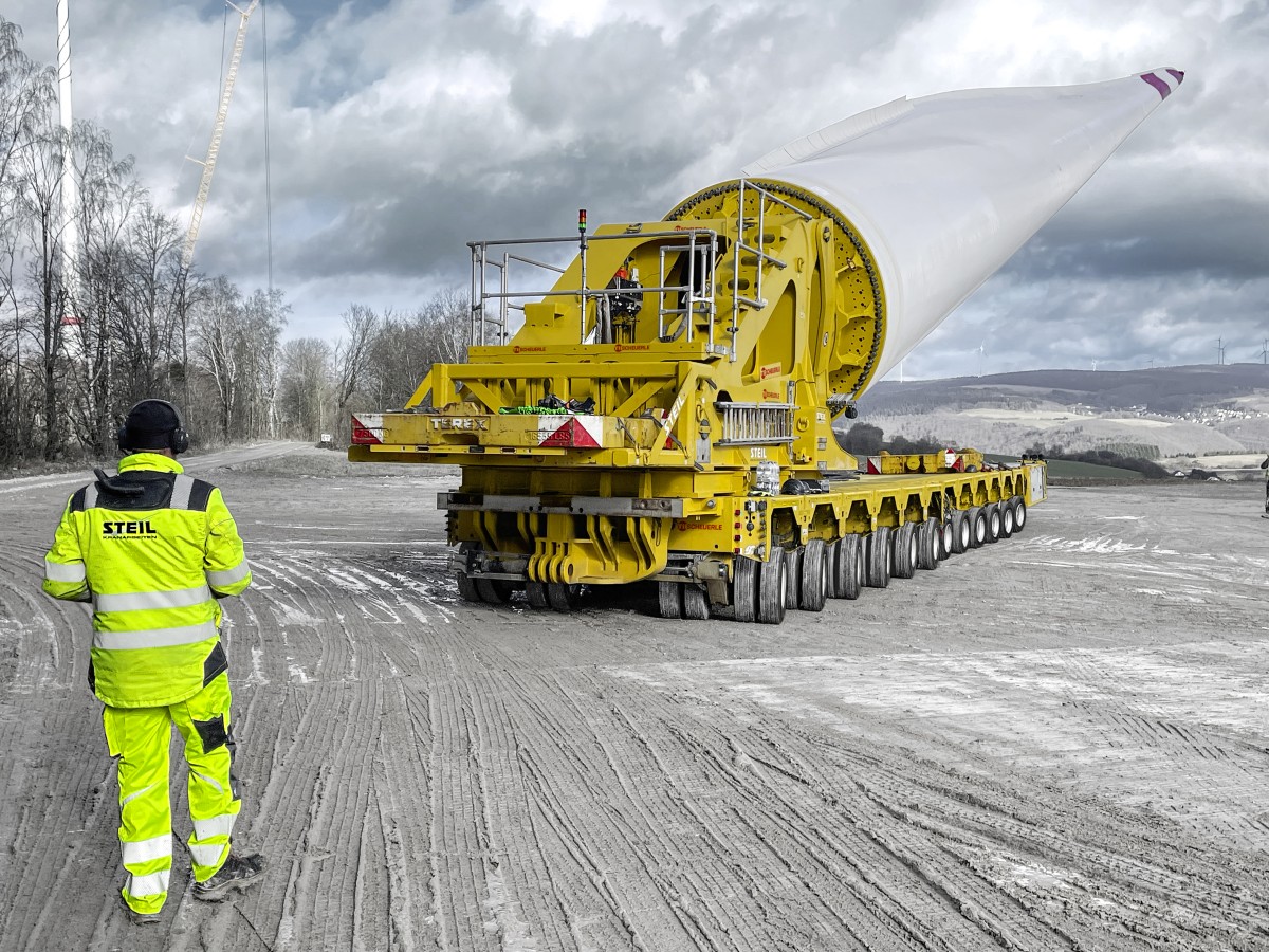
BladeLifter from TII SCHEUERLE is the perfect choice for even the longest rotor blades
The fourth generation SCHEUERLE BladeLifter allows all fleet...
International
18/04/2024
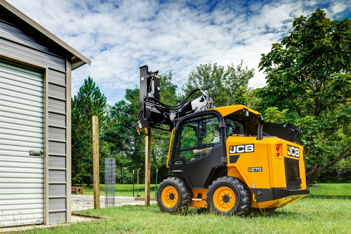
JCB: Stage V Powertrain for large platform Skid Steer Loaders
JCB has launched EU Stage V compliant versions of its large...
International
17/04/2024
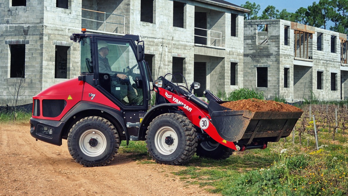
Color change signals bold new era at Yanmar CE
Yanmar Compact Equipment is undergoing a shift in its approa...
International
17/04/2024
Wirtgen Group presents numerous premières for the British market
Smarter. Safer. More Sustainable. This is the theme of the W...
International
16/04/2024
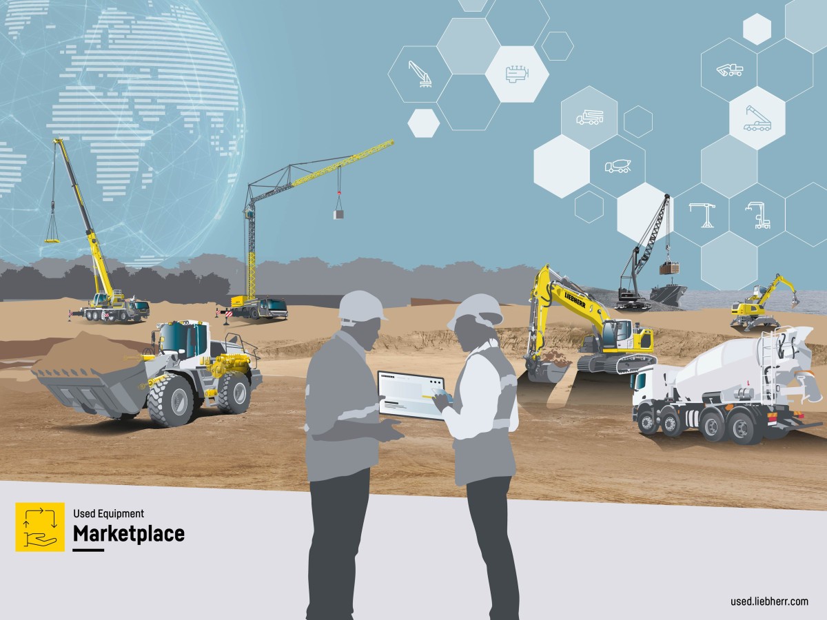
Used Equipment Marketplace: New portal for Liebherr used machines
– Digital marketplace with an extensive portfolio of used ma...
International
16/04/2024
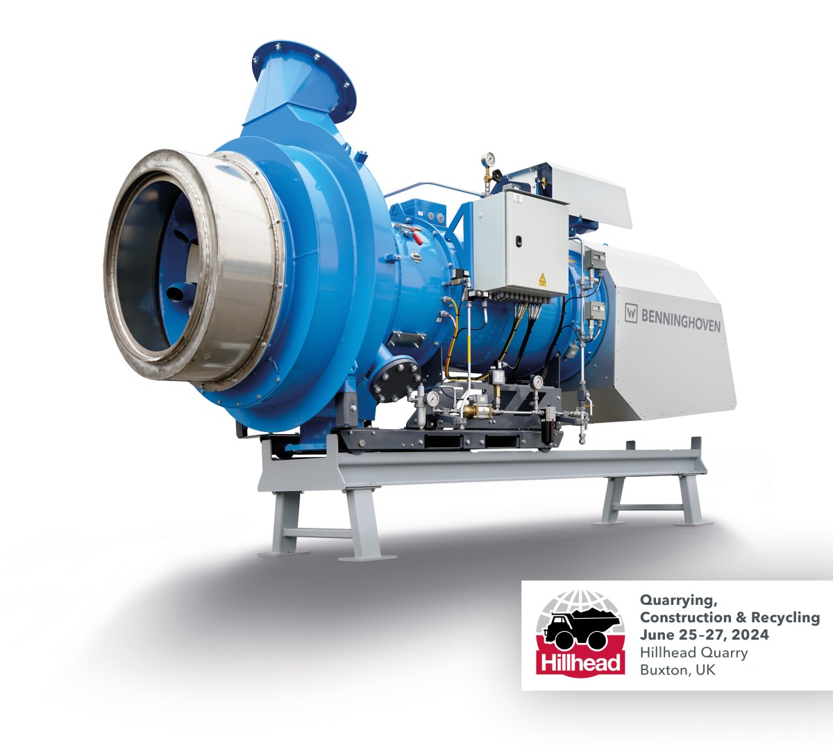
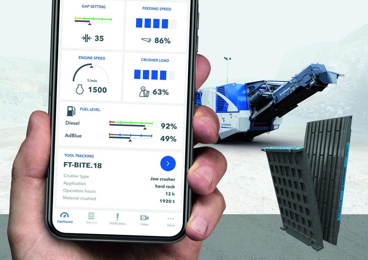
Kleemann's SPECTIVE CONNECT: now new with Tool Management
The intuitive SPECTIVE operating concept makes a significant...